Verryl V Fosnight Jr's Gallery
Alaska 2017
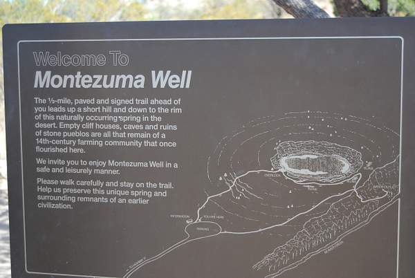
Montezuma's Well
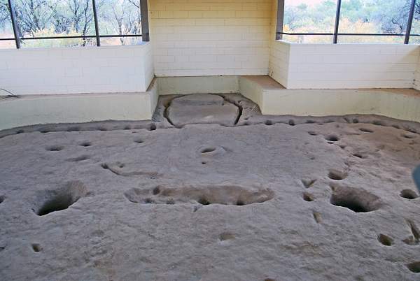
https://verrylvfosnightjr.slickpic.com/albums/Montezumas-Well/photo/#14388114
DSC_0910 Here it is. The holes are post holes and fire pit holes.
https://verrylvfosnightjr.slickpic.com/albums/Montezumas-Well/photo/#14388115
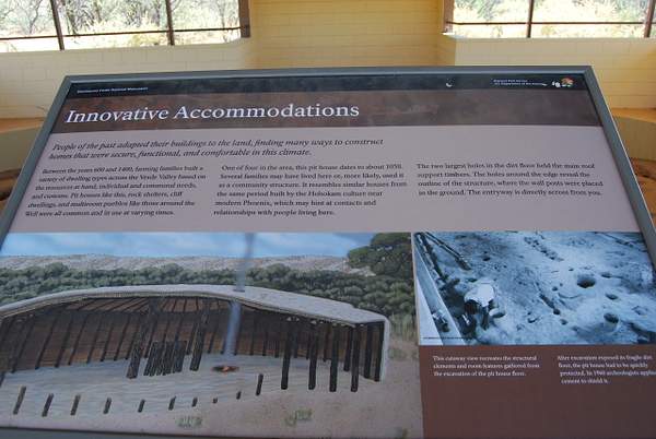
DSC_0913 The abutment was perhaps a store room or ceremonial room??
https://verrylvfosnightjr.slickpic.com/albums/Montezumas-Well/photo/#14388116
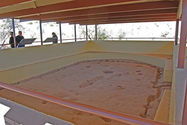
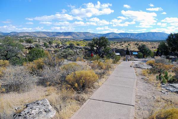
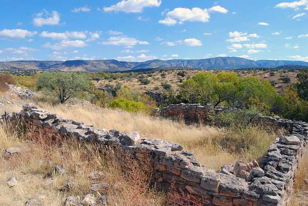
DSC_0909 This is the next stop, a wide spot in the road to park and this path to a archeologically recovered building foundation covered by the Park Service.
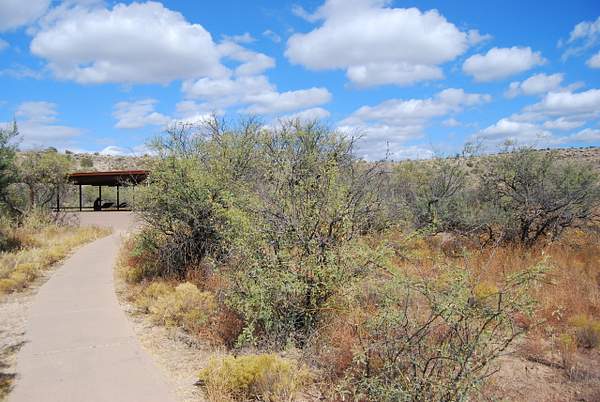
https://verrylvfosnightjr.slickpic.com/albums/Montezumas-Well/photo/#14388117
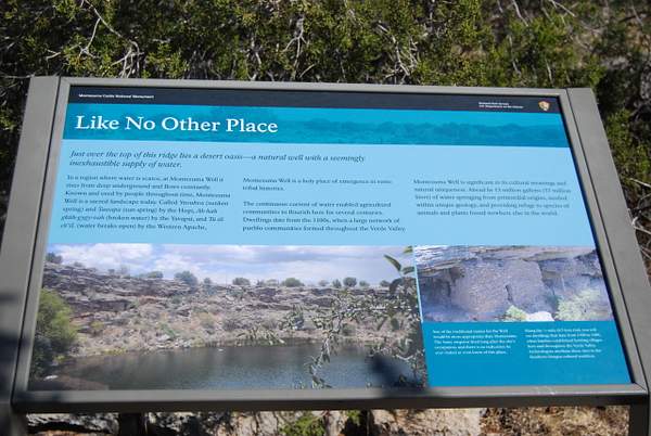
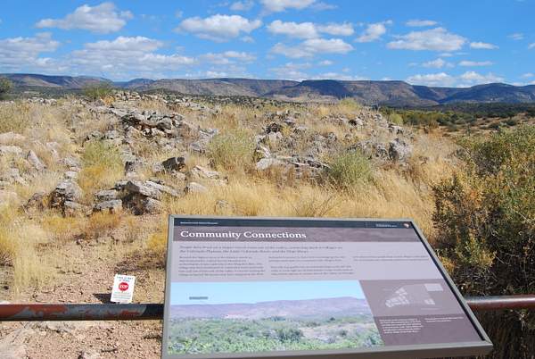
DSC_0906 The first stop along the road to the Well itself is a grassy picnic meadow surrounded by cooling trees. there are restrooms and tables, and it is bordered by ancient canals as described in this sign.
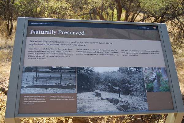
https://verrylvfosnightjr.slickpic.com/albums/Montezumas-Well/photo/#14388118
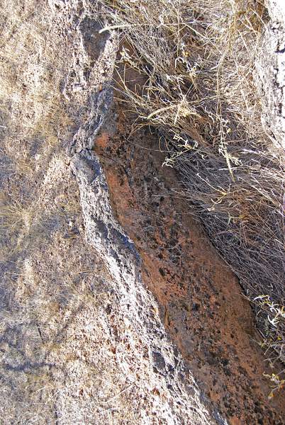
DSC_0907 This is one of the canals, now overgrown with weeds. the sides appear to have been concrete covered, but it is the calcium carbonate deposited on them by the running canal water from Montezuma's Well (see previous photo of sign).
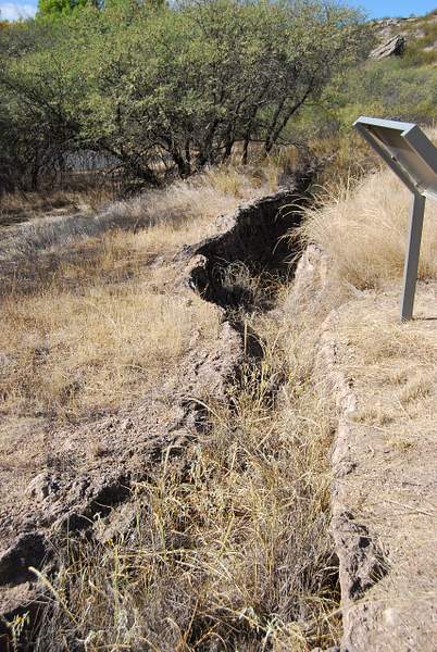
https://verrylvfosnightjr.slickpic.com/albums/Montezumas-Well/photo/#14388119
DSC_0908 The calcium carbonate laver coating the canal can be seen here.
https://verrylvfosnightjr.slickpic.com/albums/Montezumas-Well/photo/#14388120
DSC_0912 The recreation of the structure.
https://verrylvfosnightjr.slickpic.com/albums/Montezumas-Well/photo/#14388122
DSC_0914 sign at the end of the road parking lot.
https://verrylvfosnightjr.slickpic.com/albums/Montezumas-Well/photo/#14388124
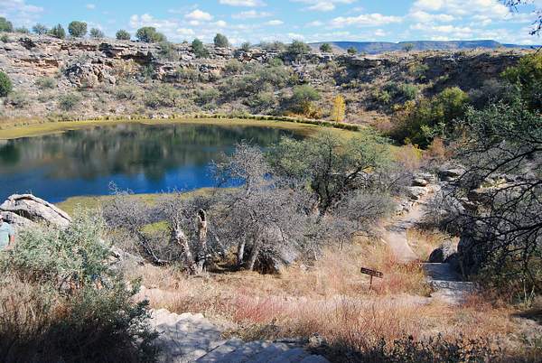
DSC_0916 Approaching the well.
https://verrylvfosnightjr.slickpic.com/albums/Montezumas-Well/photo/#14388125
DSC_0915
https://verrylvfosnightjr.slickpic.com/albums/Montezumas-Well/photo/#14388126
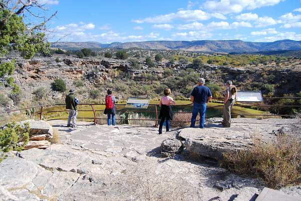
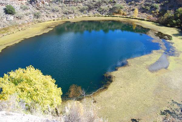
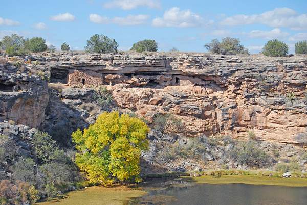
DSC_0917 Overlooking the well which is 470 feet in diameter and about 65 feet down to the water.
https://verrylvfosnightjr.slickpic.com/albums/Montezumas-Well/photo/#14388128
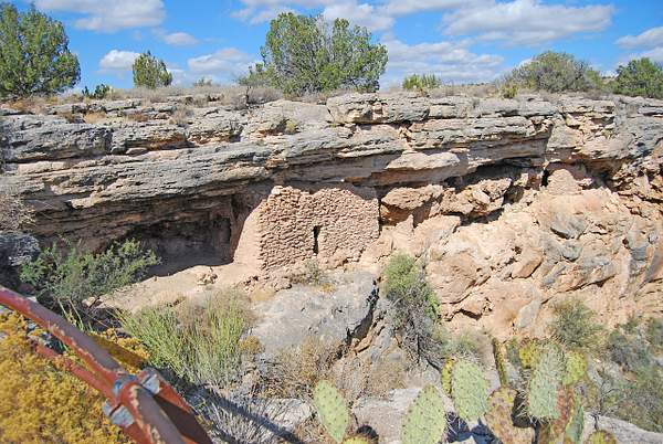
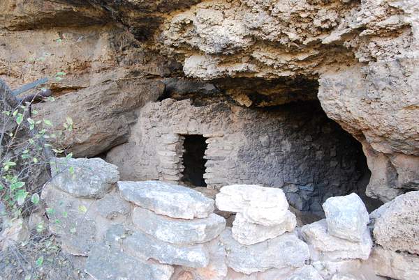
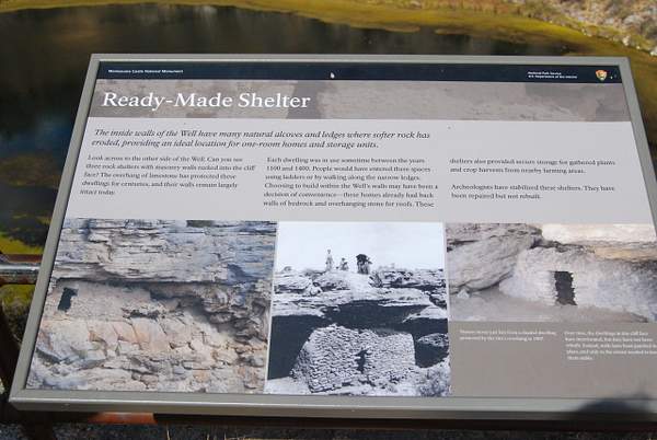
DSC_0919 Three stone houses built under the cliff.
https://verrylvfosnightjr.slickpic.com/albums/Montezumas-Well/photo/#14388129
DSC_0918
https://verrylvfosnightjr.slickpic.com/albums/Montezumas-Well/photo/#14388130
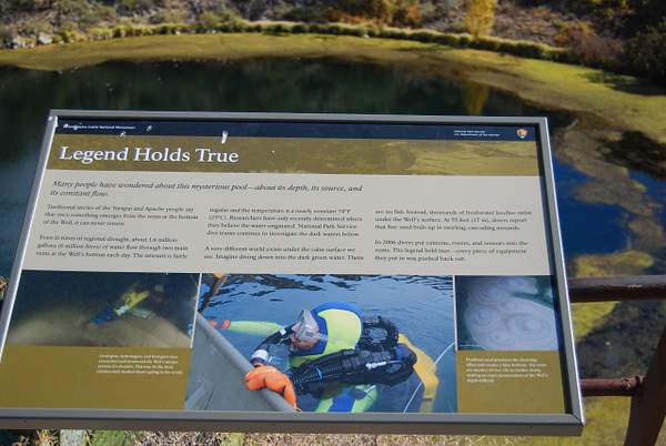
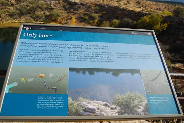
DSC_0921 The depth of the water is not know exactly, but at 55 feet depth the sandy bottom is churned by the inrushing water, which falls as rain and snow on the surrounding Mongollon Rim, and is absirbed by the ground at those high elevations, and then it filters down to the rock below the well and bubbles up. Really. The Mogollon Rim or is a topographical and geological feature cutting across the U.S. state of Arizona. It extends approximately 200 miles, starting in northern Yavapai County and running eastward, ending near the border with New Mexico.
https://verrylvfosnightjr.slickpic.com/albums/Montezumas-Well/photo/#14388131
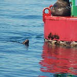
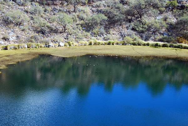
DSC_0922 Ducks (Whippins, or something like that???) the guide called them.
https://verrylvfosnightjr.slickpic.com/albums/Montezumas-Well/photo/#14388132
DSC_0923
https://verrylvfosnightjr.slickpic.com/albums/Montezumas-Well/photo/#14388133
DSC_0925
https://verrylvfosnightjr.slickpic.com/albums/Montezumas-Well/photo/#14388134
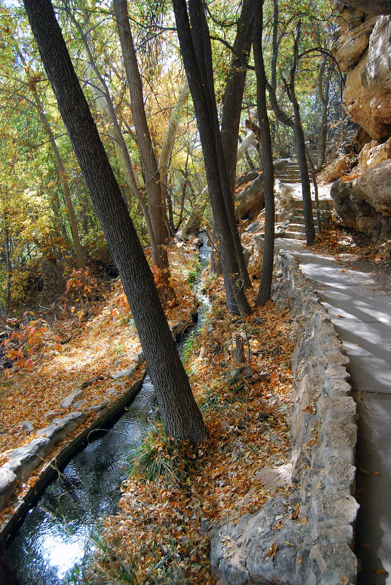
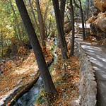
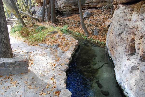
DSC_0926 A bit around the rim overlook is a stairway path down to the exit stream of the water out to the adjoining creek and the ancient constructed canals.
https://verrylvfosnightjr.slickpic.com/albums/Montezumas-Well/photo/#14388136
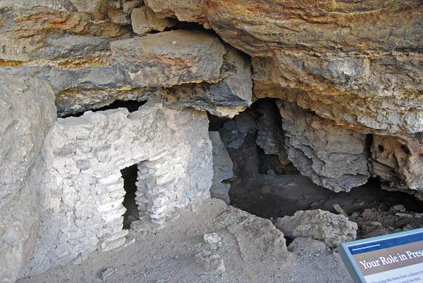
DSC_0928 A house on the way down.
https://verrylvfosnightjr.slickpic.com/albums/Montezumas-Well/photo/#14388137
DSC_0930 Same house from another angle showing more of the cave in which it is built.
https://verrylvfosnightjr.slickpic.com/albums/Montezumas-Well/photo/#14388138
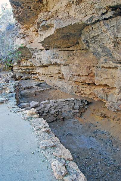
DSC_0932 At the end of the train down, near the water level are the remains of more houses.
https://verrylvfosnightjr.slickpic.com/albums/Montezumas-Well/photo/#14388139
DSC_0934 The stream out of the well
https://verrylvfosnightjr.slickpic.com/albums/Montezumas-Well/photo/#14388140
DSC_0946
https://verrylvfosnightjr.slickpic.com/albums/Montezumas-Well/photo/#14388141
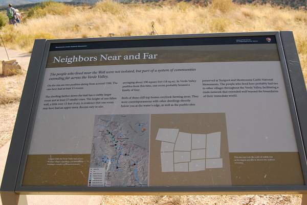
DSC_0944 Up on the rim of the well, is a pueblo of at least 11 rooms, was one of several vilages in the present day Verde Valley.
https://verrylvfosnightjr.slickpic.com/albums/Montezumas-Well/photo/#14388142
DSC_0947 A better view of the three rooms near the rim. The rim overlook is at the left from where I took the earlier photo.
https://verrylvfosnightjr.slickpic.com/albums/Montezumas-Well/photo/#14388143
DSC_0949
https://verrylvfosnightjr.slickpic.com/albums/Montezumas-Well/photo/#14388145
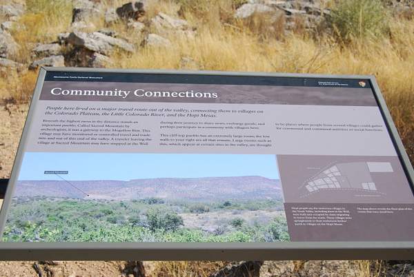
DSC_0948 Another pueblo near the rim on the trail back to the parking lot. This is a good view of part of the Mongollan Rim.
https://verrylvfosnightjr.slickpic.com/albums/Montezumas-Well/photo/#14388146
DSC_0950 This is probably the large room referred to in the previous sketch on the sign.
https://verrylvfosnightjr.slickpic.com/albums/Montezumas-Well/photo/#14388179
DSC_0953 Nearer the exit flue.
https://verrylvfosnightjr.slickpic.com/albums/Montezumas-Well/photo/#14388181
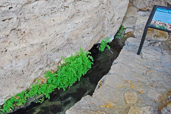
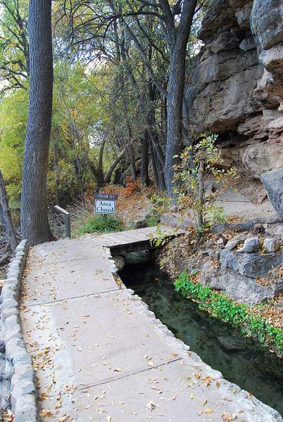
DSC_0954 The water comes under this rock into the man made by ancients canal.
https://verrylvfosnightjr.slickpic.com/albums/Montezumas-Well/photo/#14388182
DSC_0952 Along this path is the reconstructed original canal out of the well. The water is flowing away form the camera and from a hole in the rim, naturally at the well water level inside the rim.
https://verrylvfosnightjr.slickpic.com/albums/Montezumas-Well/photo/#14388183
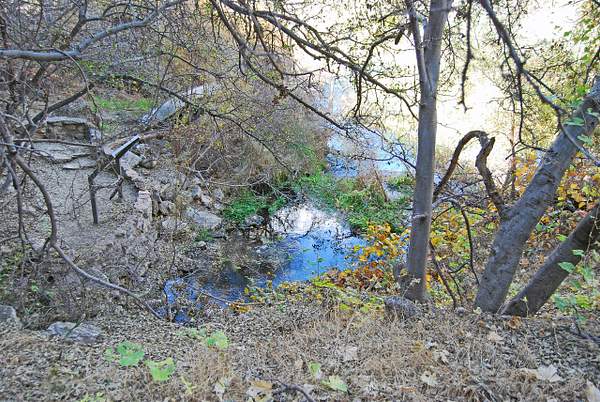
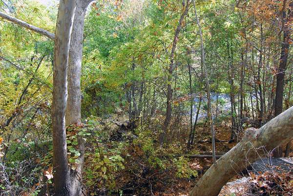
DSC_0951 Proceeding along the path away from the rim and back toward the parking lot, is the Wet Beaver Creek, and some lush wooded areas.
https://verrylvfosnightjr.slickpic.com/albums/Montezumas-Well/photo/#14388185
DSC_0957 A strance and large tree growing at about 40 degrees from the horizontal and then branching vertically up. The end of the angle section of trunk shows a healed wound of a broken off limb or trunk that is long gone.
https://verrylvfosnightjr.slickpic.com/albums/Montezumas-Well/photo/#14388186
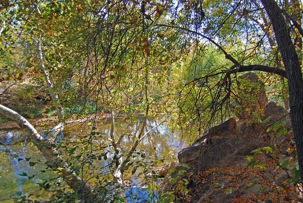
DSC_0959 The Wet Beaver Creek that flows past the well. I do not know if some water from the canals now, or ever did, enter the creek before the ancient construction,
https://verrylvfosnightjr.slickpic.com/albums/Montezumas-Well/photo/#14388187
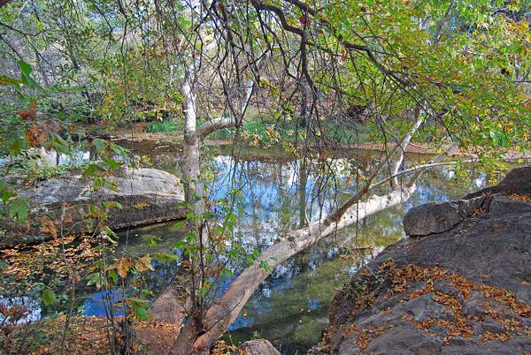
DSC_0961 I'm going to remember this cool spot next summer when we can't get away to CA. The signs claim it is 20 degrees cooler near the well and the flowing water than out on the desert.
https://verrylvfosnightjr.slickpic.com/albums/Montezumas-Well/photo/#14388189
DSC_0962 The canal above the creek as I walked back from the exit flue.
Scroll To Top
Audio Mute
Prev
Play
Next
Shuffle
Include
This site uses cookies to enhance your browsing experience, serve personalized content, and analyze traffic. By continuing to use this site you agree to
use of cookies and stewardship of your data .


No comments yet...
All fields are required, fill in the form.
Comment successfully added.
Comment